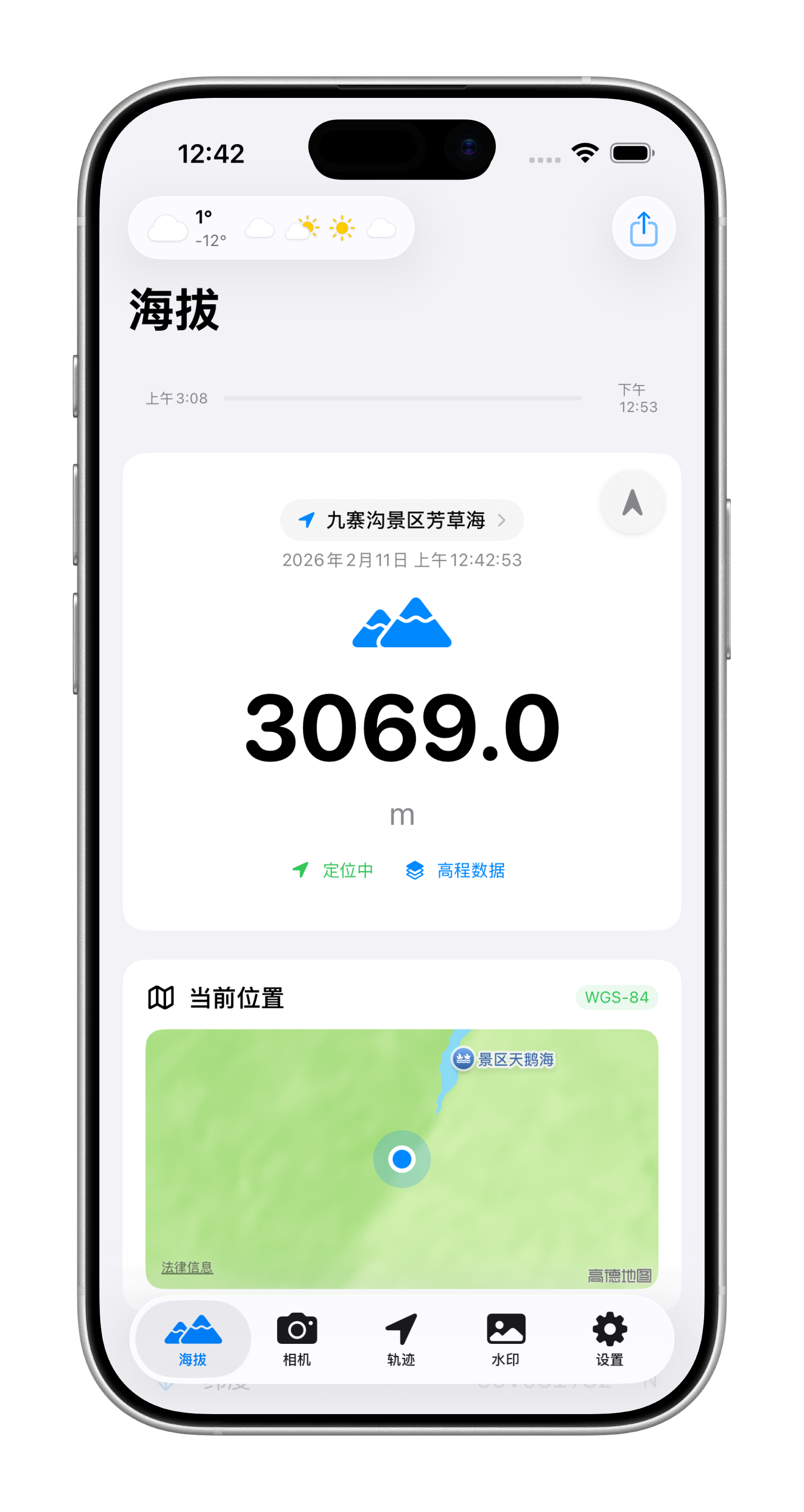
Live Elevation
Read altitude instantly with source confidence, so you know what to trust before you move.
IncludedAltitude+
Altitude, routes and photo metadata stay together automatically, so your outdoor memories stay clear.
Hiking, cycling, camping or flying: Altitude+ keeps your position, elevation and media in one clean workflow.
Read altitude instantly with source confidence, so you know what to trust before you move.
IncludedTrack each session with pause, waypoints and GPX support, then replay every detail later.
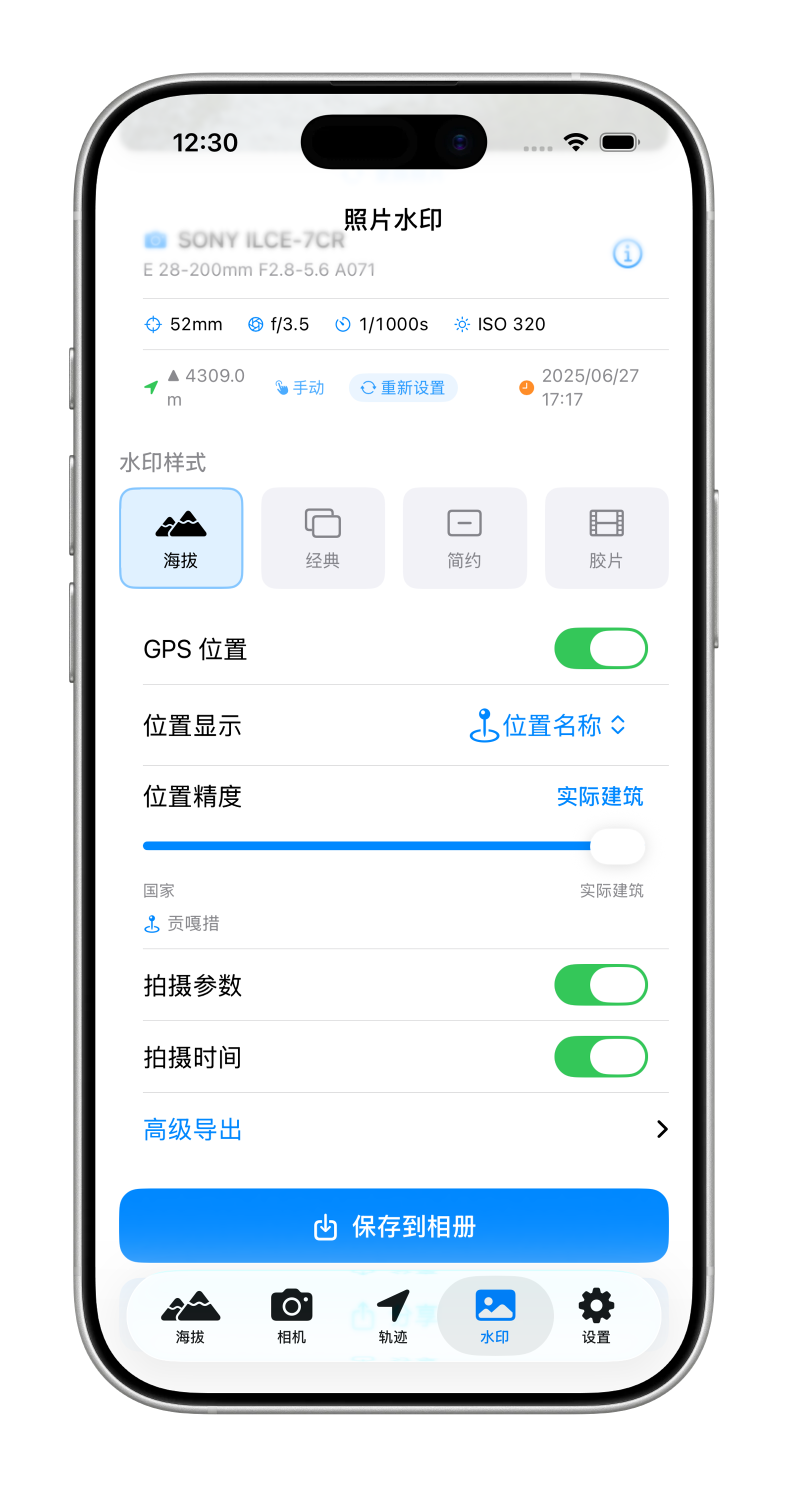
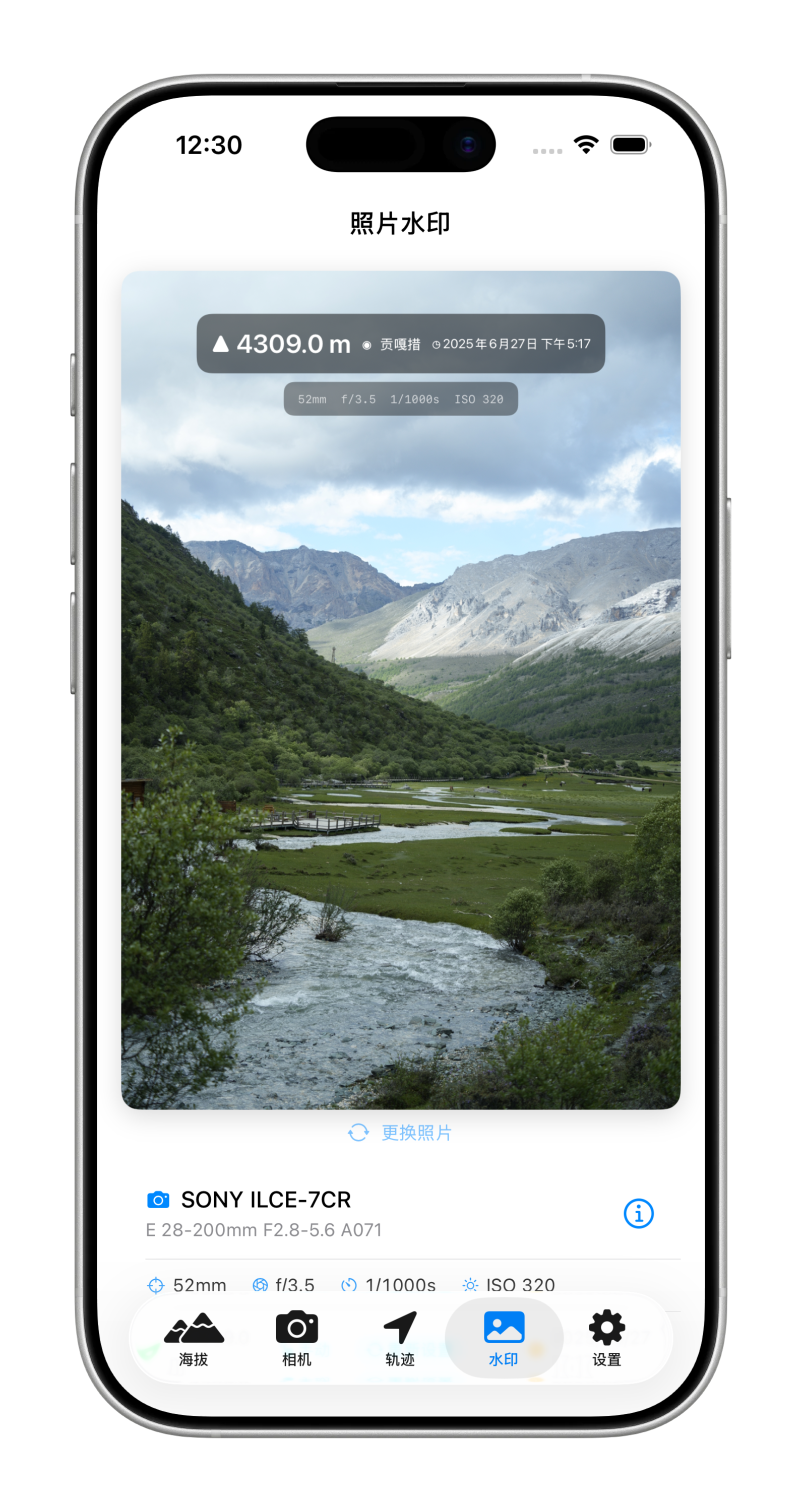
Free + ProStamp elevation, location and time directly onto photos and videos while you shoot.
Free + ProUse Live Activity, weather and iCloud sync to keep every trip connected across Apple devices.
IncludedExperience
Every section is focused on one user value, so you can understand what changes for you at a glance.
Watermark Studio
Fine-tune altitude, location precision and visual style before export in seconds.
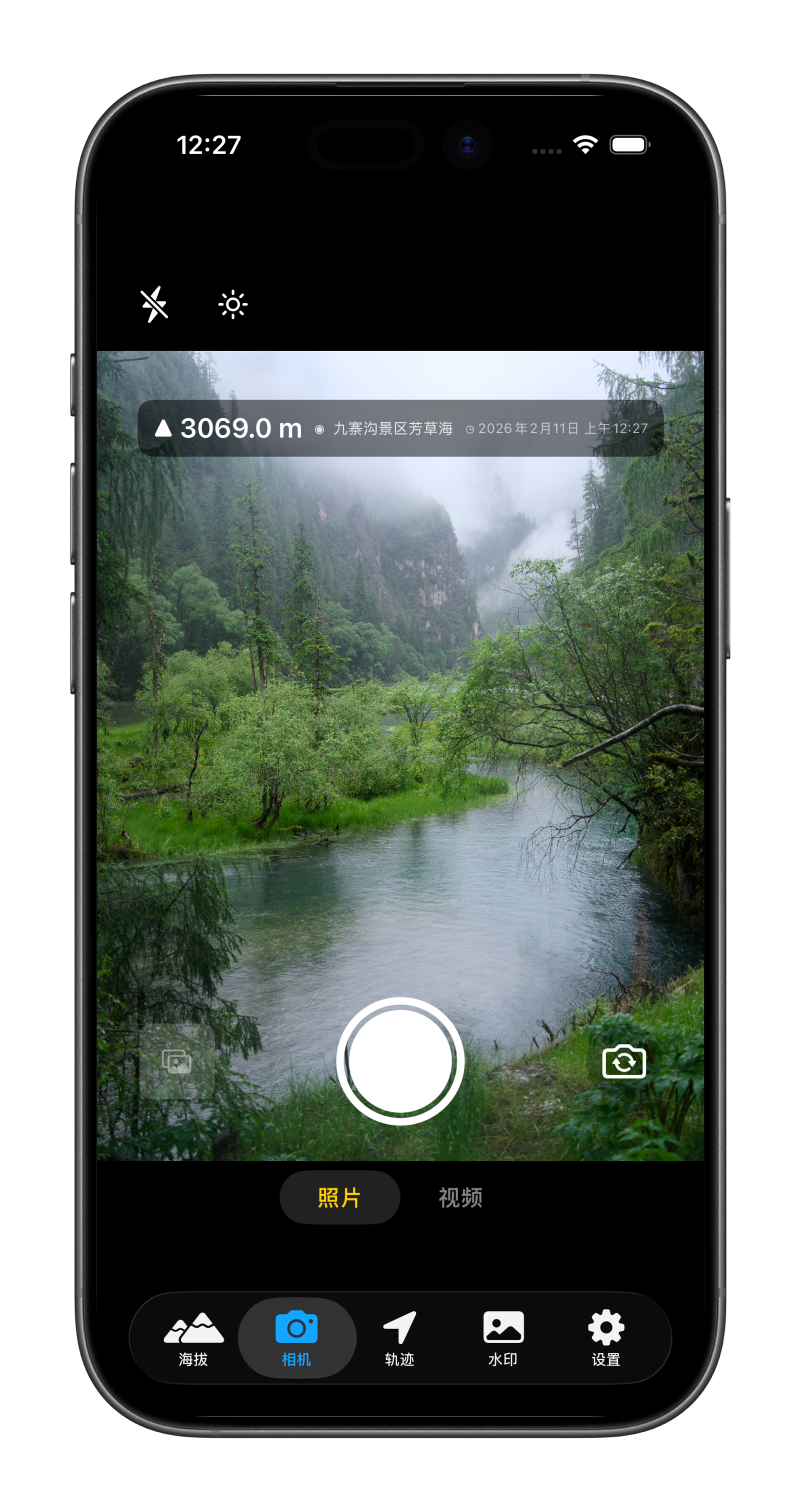
Altitude Camera
Capture photos and video with altitude, position and timestamp overlays in real time.
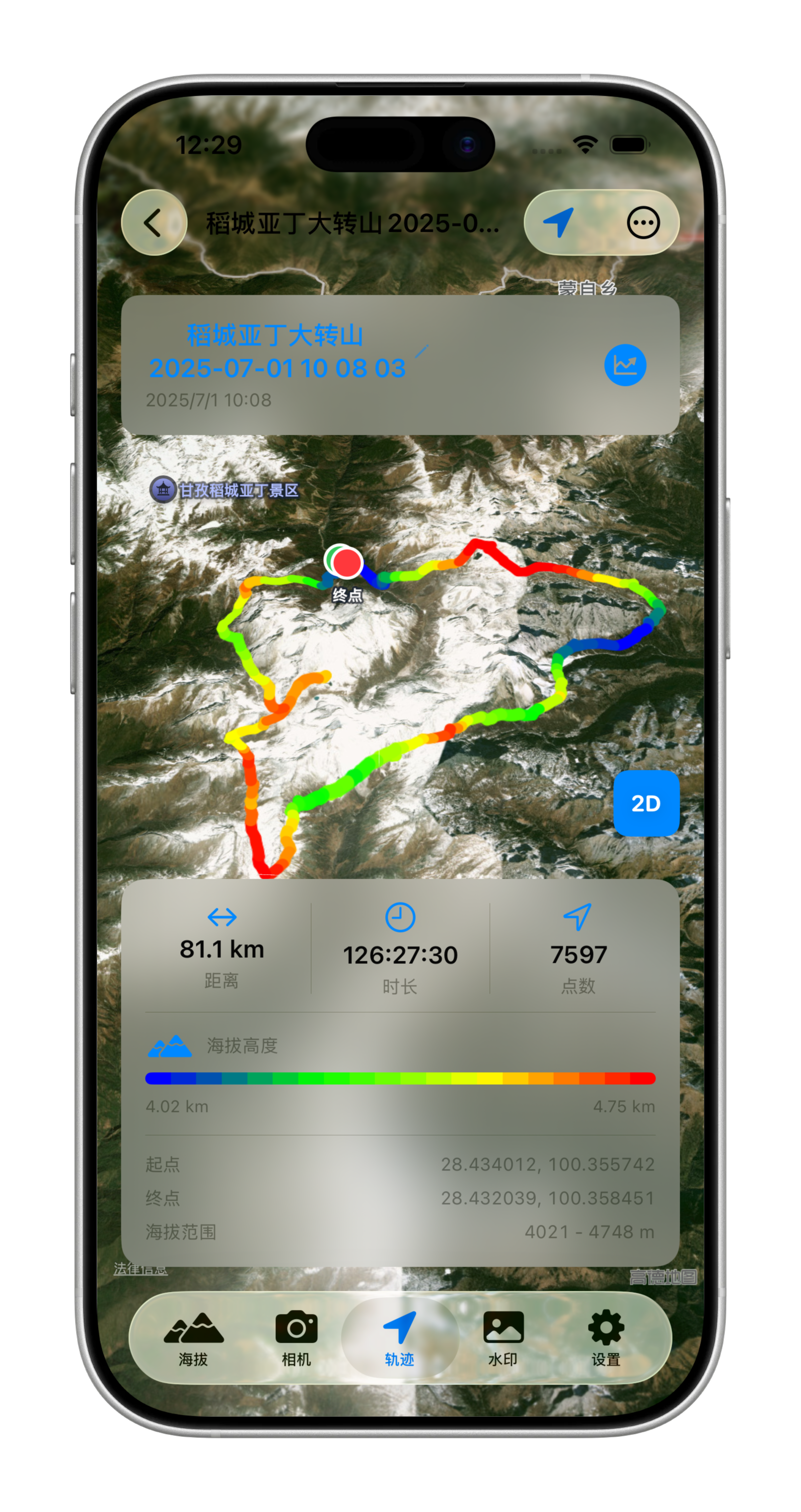
Track Replay 2D
Review speed and elevation color maps side by side to quickly spot key moments.
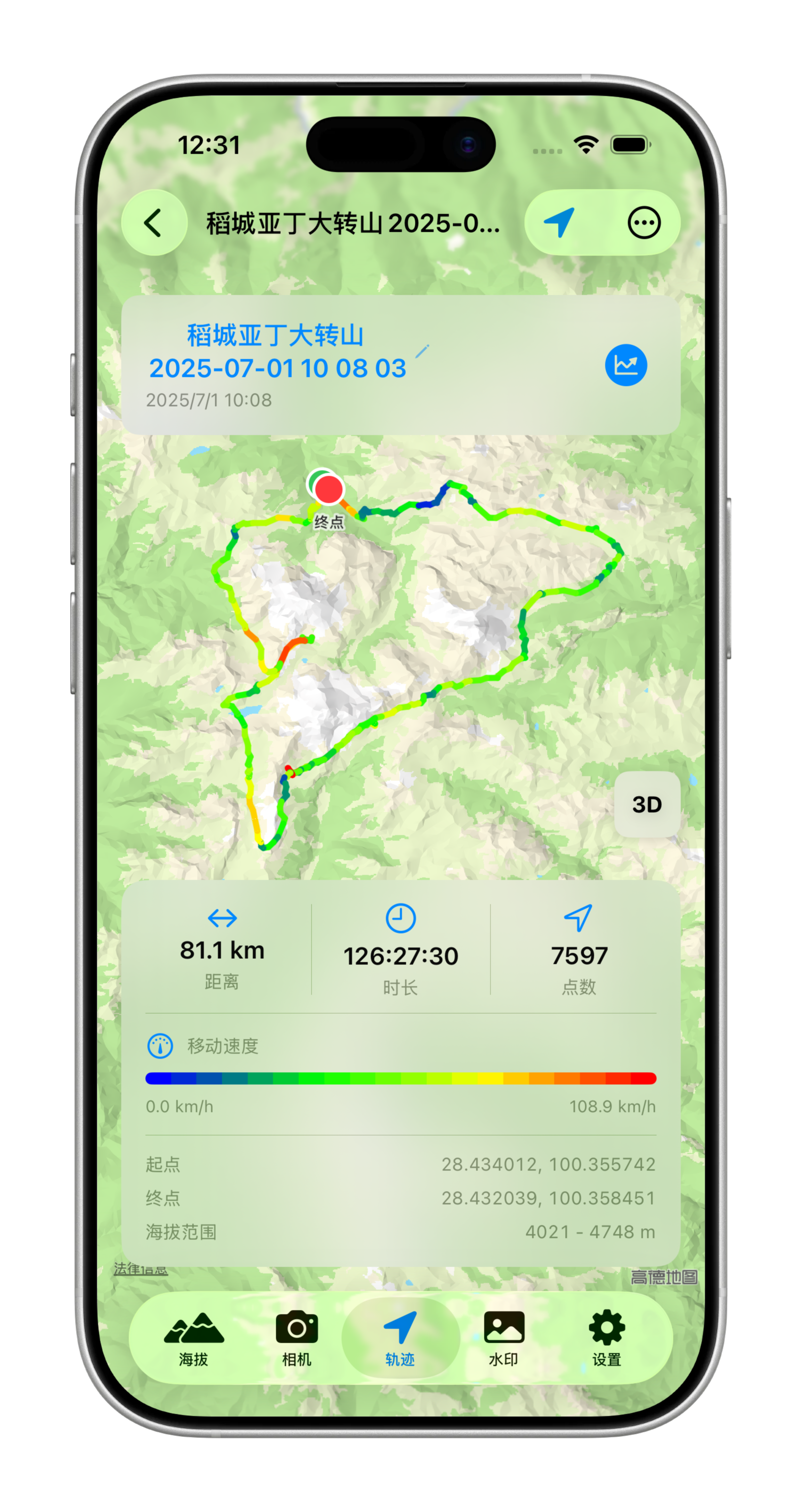
Track Replay 3D
Pro adds 3D replay so climbs, drops and pace changes are immediately visible.
Watermark Result
Get polished outputs that keep both visual atmosphere and useful location context.
Free and Pro
| Feature | Free | Pro |
|---|---|---|
| Video capture | 1080p 30 FPS | 4K 60 FPS |
| Track sessions | Up to 3 | Unlimited |
| Photo & watermark edits | Up to 3 each | Unlimited |
| GPX import/export | Up to 2 | Unlimited |
| Gradient, 3D and analytics | Not included | Included |
From first step to summit, every elevation change is captured clearly.